Updated 29 August 2003. Comments to Harold Brooks)

Period |
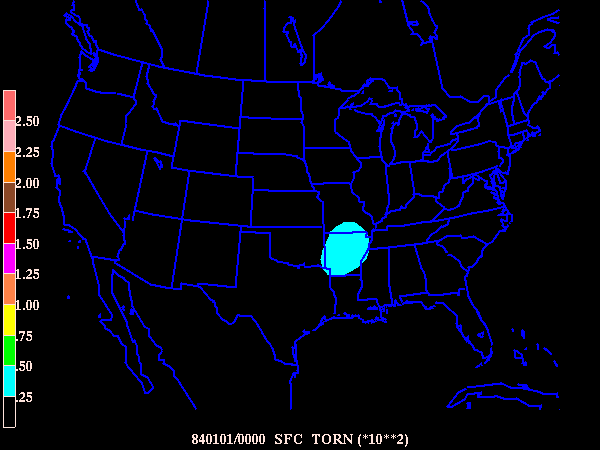
Any Tornado |
Hail (3/4 inch diam. or greater or damaging) |
Thunderstorm winds (50 kts or greater or damaging) |
|---|---|---|---|
| 1980-1999 (all 20 yrs.) |
Java applet | Java applet | Java applet |
| 1980-1984 | Looping gif | Looping gif | Looping gif |
| 1985-1989 | Looping gif | Looping gif | Looping gif |
| 1990-1994 | Java applet | Java applet | Java applet |
| 1995-1999 | Java applet | Java applet | Java applet |
Period |
Significant Tornado (F2 or greater) |
Violent Tornado (F4 or greater) |
Hail (2 inch diam. or greater) |
Thunderstorm winds (65 kts or greater) |
|
|
|
|
||
|
|
|
|||
|
|
|
|
Click here to see individual frames from "High-End
Severe Weather" loops above.