
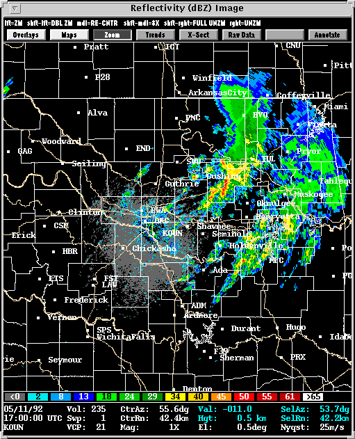
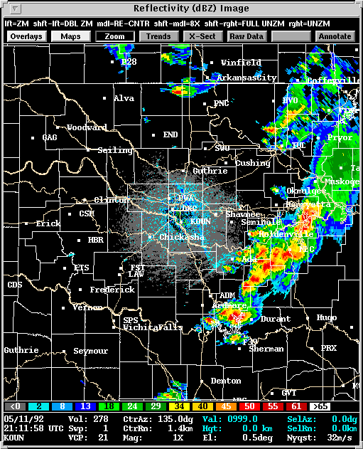
On the smaller, meso and storm scales, the event presented interesting storm interactions which ultimately determined which areas were to bear the brunt of the outbreak. Observing this tornado outbreak was the WSR-88D radar for which the NWS in Norman, Oklahoma was one of the early test sites. WSR-88D radar data from Norman on 11 May 1992 became a benchmark for developing mesocyclone and tornado detection algorithms at NSSL. As of the date this web page was created (May 18, 1998), this case represents the largest daily tornado outbreak since then (22 tornadoes total).
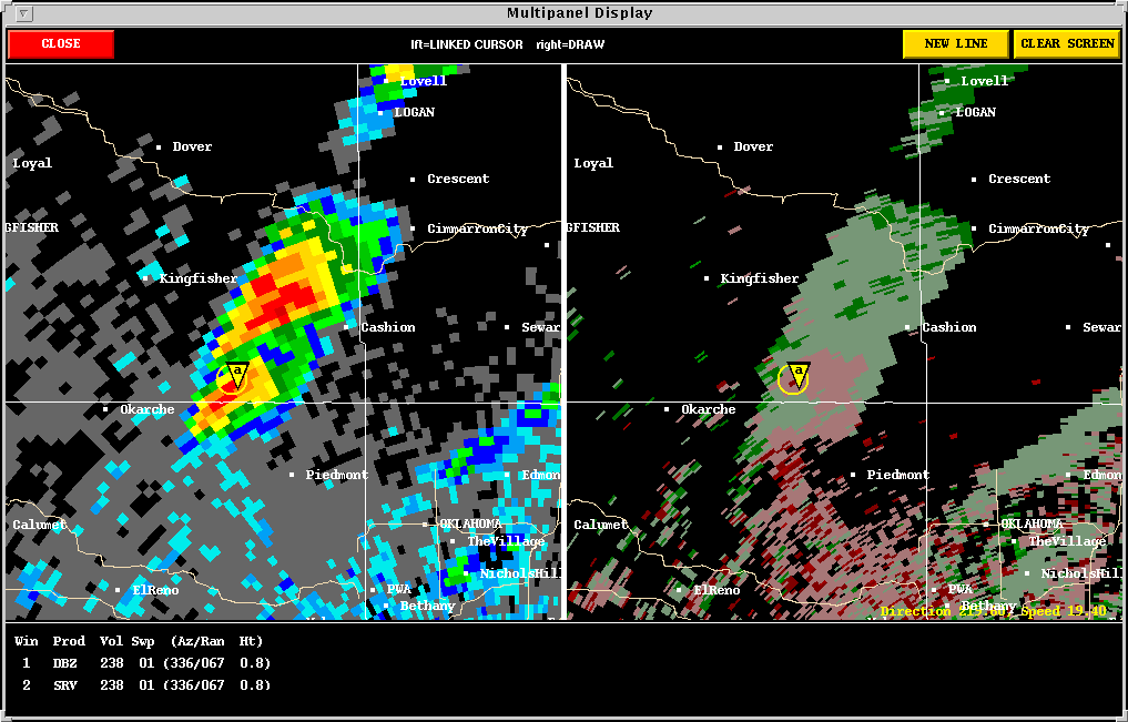
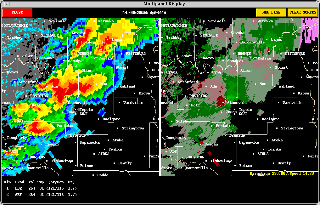
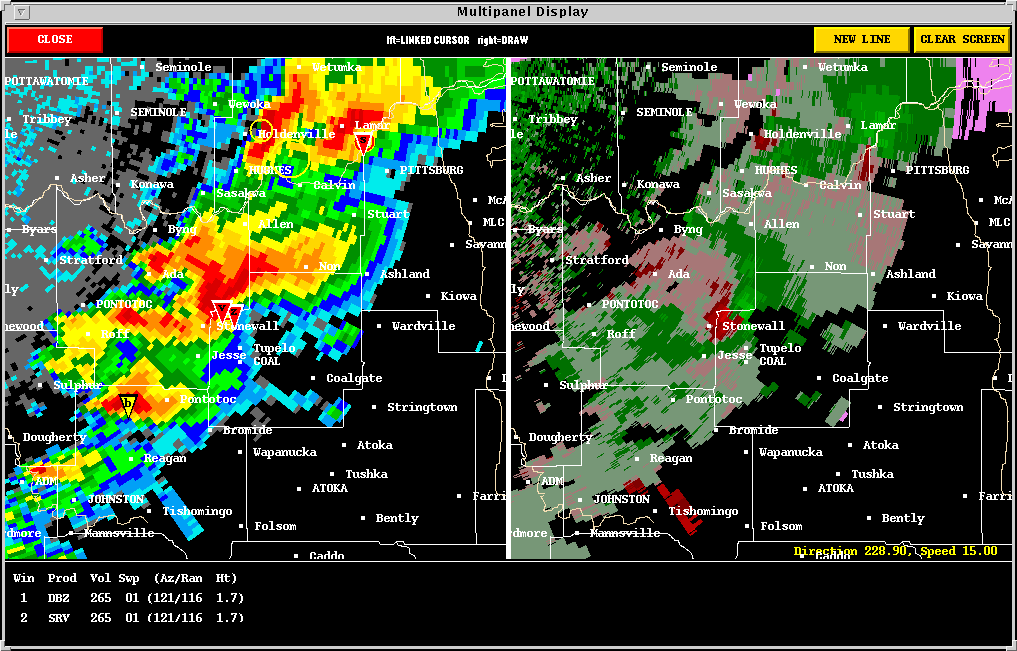
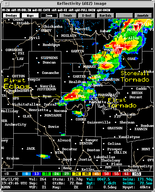
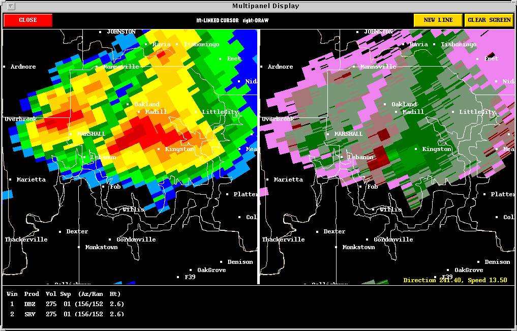
Presented here are various WSR-88D radar images from the Norman, OK
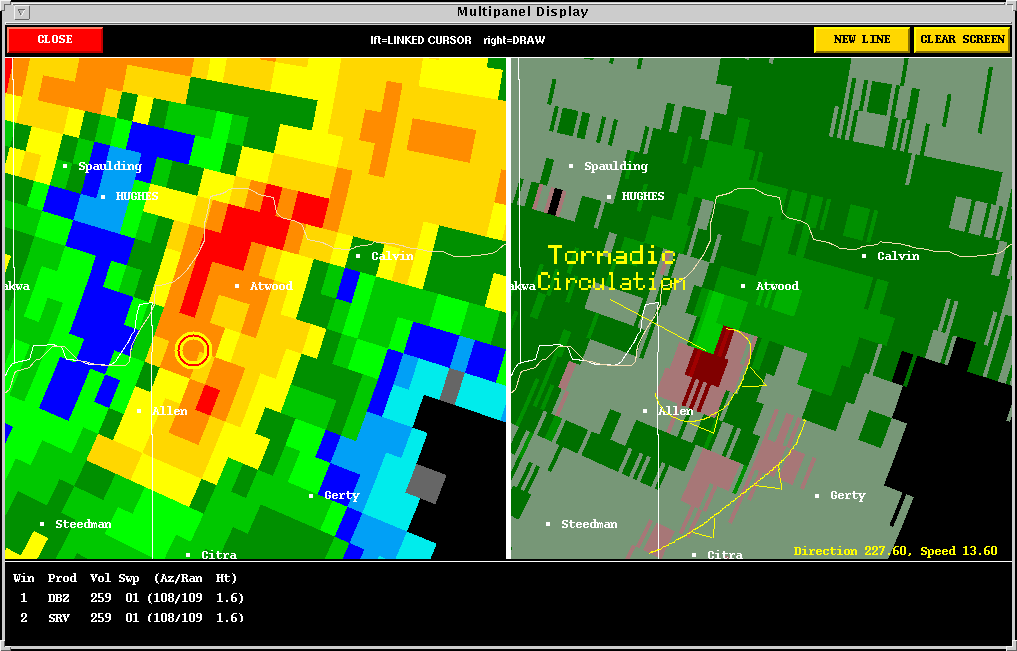
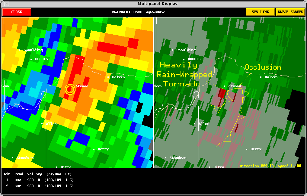
(KOUN) radar. Included in some of the images is output from NSSL's Mesocyclone
Detection Algorithm (MDA) and Tornado
Detection Algorithm (TDA). A yellow circle represents a mesocyclone
as detected by the MDA. The red-in-yellow circle represents a mesocyclone
whose base is at the lowest radar scan (where it is a more likely tornado
threat). A red triangle indicates the location of a tornado as detected
by the TDA.
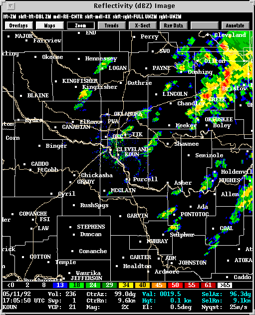
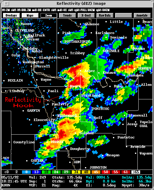
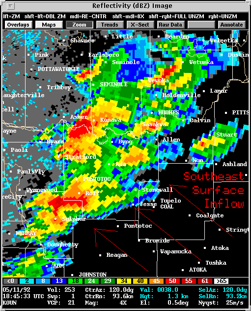
Sooner or later, though, the southernmost storms tend to dominate, as in the case of the Sulphur storm. This storm put down its first tornado to the northeast of Sulphur and became a long track, cyclic supercell. It's presence would probably have limited the lifetime of any storms to its immediate north, but other cells formed in areas of sufficient convergence ahead of the main line. These cells were then able to tap in to uninhibited inflow and became tornado threats.
The Overview image illustrates storm competition for inflow. The Sulphur storm on the lower left robs the Byars/Stratford storm of its inflow (upper left), causing the latter to weaken. However, the cells ahead of the line, to the northeast of the Sulphur storm, are unaffected. The storm Evolution Loop illustrates the rapid intensification of one cell ahead of the line (develops a reflectivity hook) and the steady demise of the Byars/Stratford storm.
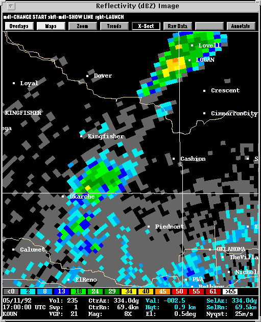
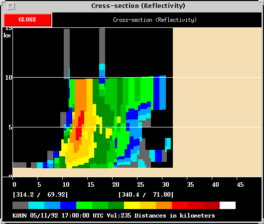
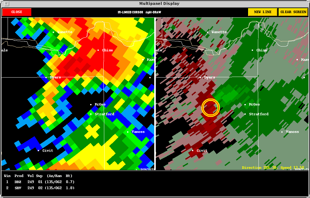
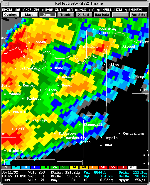
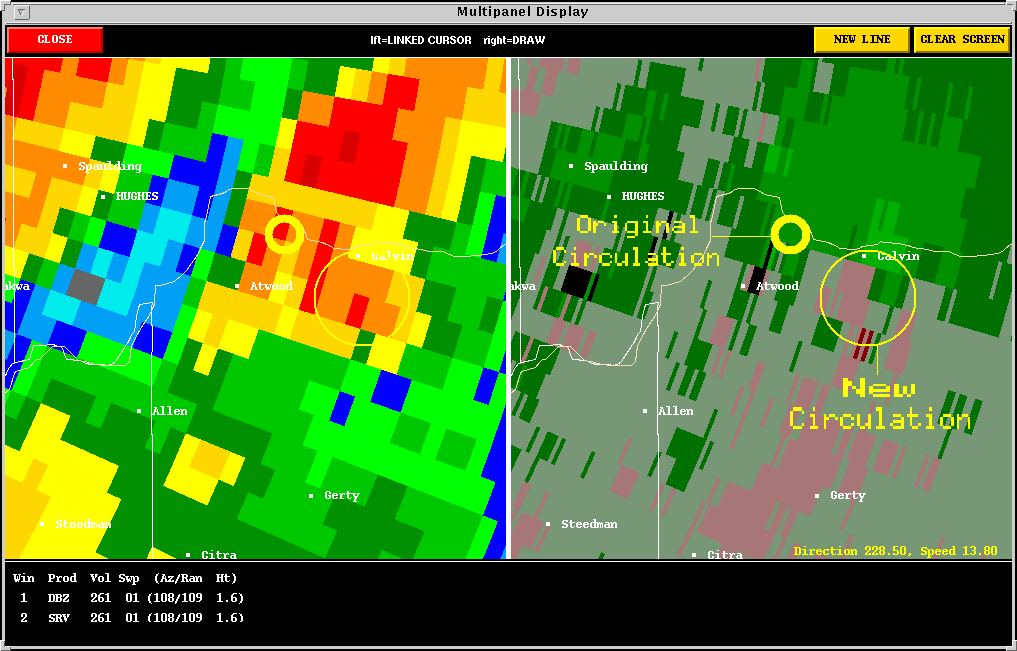
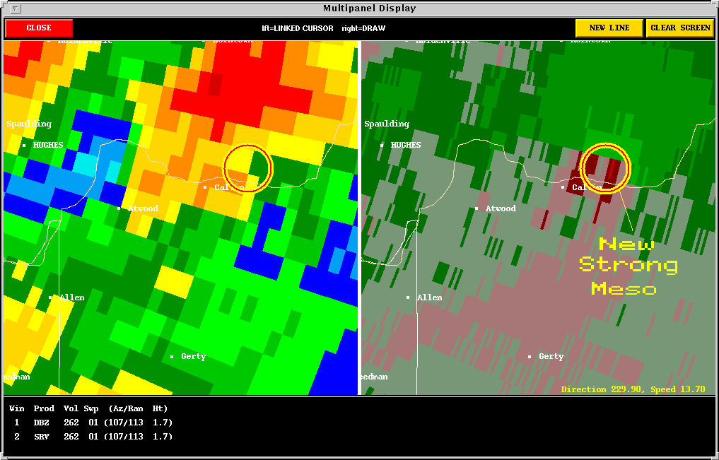
The intensifying cell with a reflectivity hook proceeded to produce the Atwood tornado. This storm presents an interesting look at cyclic tornado formation. In the 1920 UTC image the Atwood tornado is forming, but already its warm, moist inflow is being forced up and around an outflow boundary to the southeast. In the 1926 UTC image the tornado is at its peak observed intensity, but is rapidly becoming occluded by yanking the outflow boundary further north and east. By the time of the 1932 UTC image the first tornado is fairly well occluded while a new circulation is developing along the outflow boundary (essentially an RFD gust front) to its southeast. Six minutes later, at 1938 UTC, the new circulation is dominant and rapidly becoming a tornado threat. This new meso, then, undergoes the same process as one circulation occludes on the northwest side of the parent meso and a new circulation forms to its east-southeast (1943 UTC and 1949 UTC).
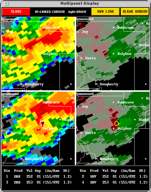
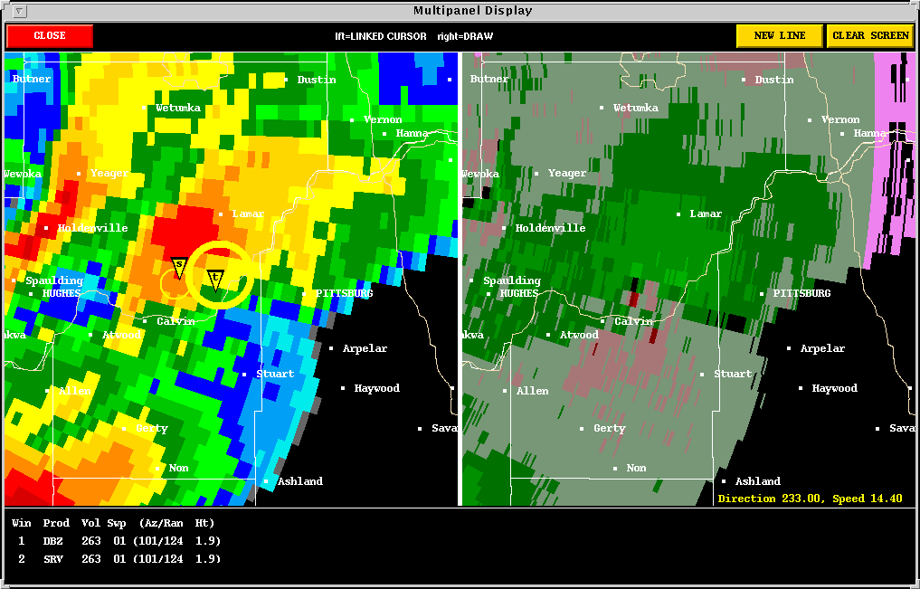
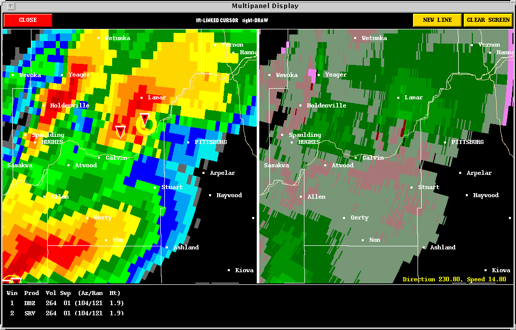
Also at 1949 UTC, the Sulphur,
Long-track, cyclic supercell continued to show a dangerous meso which produced
its next tornado around 1955 UTC near
Stonewall.
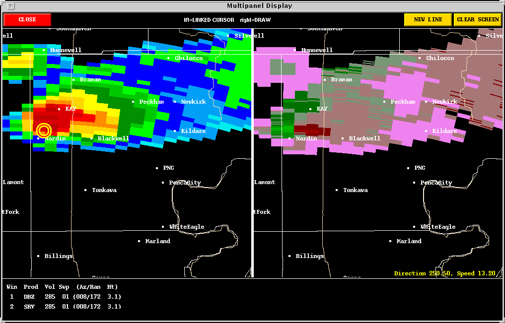
The Kay County storm formed north of the suface low and dryline bulge. It too was tornadic, and the meso shows up very well considering the distance from the radar at 2152 UTC.
The storms across southeastern Oklahoma continued to produce tornadoes before forming a squall line.
Back to NSSL SWAT Case Study Table of Contents Page.