
NSSL SWAT Case Study - 13 June 98 Oklahoma City Dryline Supercell Tornadoes
This page provides a preliminary look at the Oklahoma City (KTLX) WSR-88D
radar data from Saturday, the13th of June, 1998. Oklahoma City experienced
its first significant tornado since 1992. The supercell thunderstorm
responsible produced occassional tornadoes, some damaging, as it moved
from western Canadian county across Oklahoma couny and into Lincoln county
where it weakened. The most destructive tornado struck north Oklahoma
City near Interstates 35 and 44, and has been given a preliminary ranking
of F2 on the Fujita tornado damage scale.
Presented here are various WSR-88D radar images from the Oklahoma City
(KTLX) WSR-88D radar. Included in some of the images is output from NSSL's
Mesocyclone Detection
Algorithm (MDA) and Tornado
Detection Algorithm (TDA). A yellow circle represents a mesocyclone
as detected by the MDA. The red-in-yellow circle represents a mesocyclone
whose base is at the lowest radar scan (where it is a more likely tornado
threat). A red triangle indicates the location of a tornado as detected
by the TDA.
-
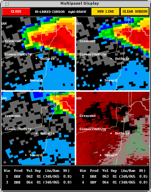
THE GUTHRIE SUPERCELL TORNADO:
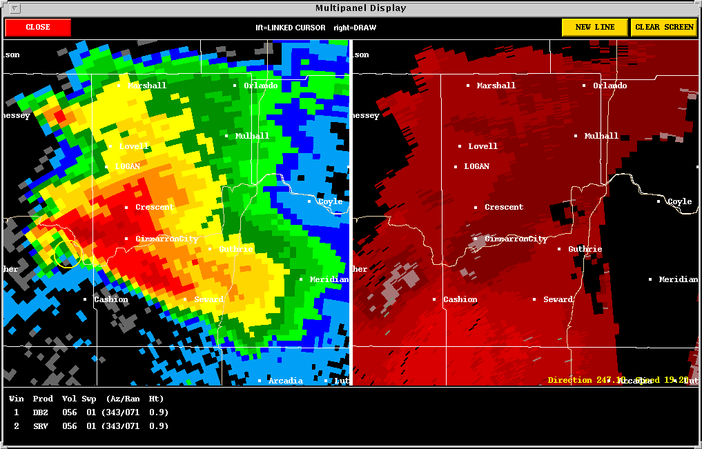
Description: The Guthrie storm began its tornado development
around 2308 UTC when an RFD began to descend to the ground from the back
side of the storm updraft. The KTLX base storm relative velocity
image at 2308 UTC showed near uniform inflow into the storm with no evidence
of rotation. The reflectivity pattern, however revealed a small hook
shape associated with a mid-level mesocyclone (2308
UTC). Further evidence of a mid-level meso existed at radar
Sweep 4.
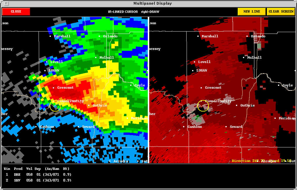
The RFD made its first significant appearance at the base scan at 2320
UTC. The RFD was clearly evident by 2332
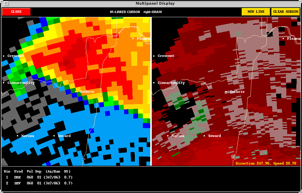
UTC. A tornado developed at the north side of the RFD; it then
occluded and moved north. The Six Panel
image illustrates the tornado formation sequence. The RFD gust front
is evidenced by the green pixels which denote winds inbound toward the
radar. The tornadic circulation is denoted by side by side inbound
and outbound velocities which are located at the north end of the RFD gust
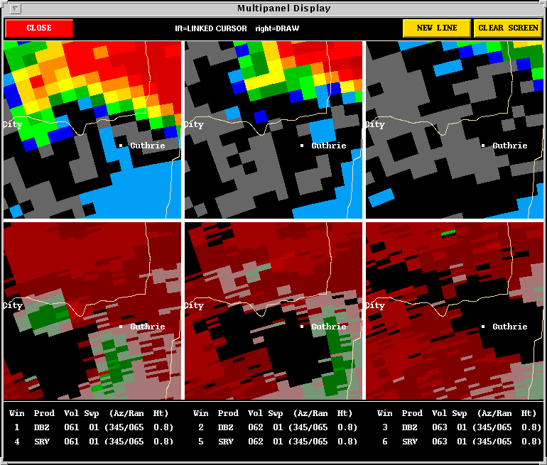
front. The Four Panel
image follows the parent thunderstorm as it dissipates. The storm
had been moving east, making use of the strong directional shear in the
environment. The four panel image clearly shows how the storm began
to lift northward and weaken as a result.
-
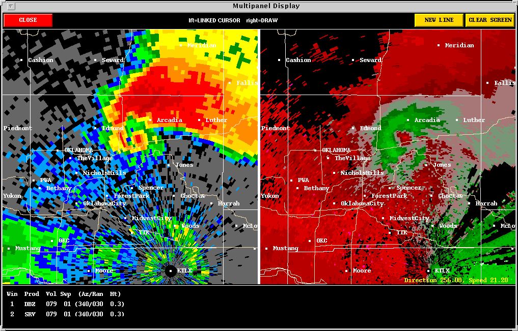
THE OKLAHOMA CITY TORNADIC SUPERCELL:
-
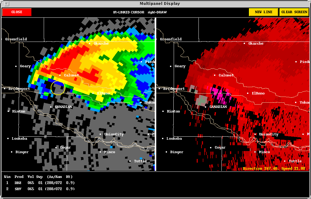
The El Reno Tornado:
Description: Just as the Guthrie storm was dying off, a new
supercell was growing in strength in western Canadian county. At
2350 UTC the storm had an impressive
reflectivity structure. A tornado warning was issued at 2356
UTC as the mid-level meso strengthened. No circulation was evident
at base scan, but there was greater than 30 knot inflow into the storm
(bright pink areas - bottom left), and the Sweep 2 images show a strong
circulation/hook echo aloft (right). The hook echo and circulation
developed to base scan level by 0003 UTC.
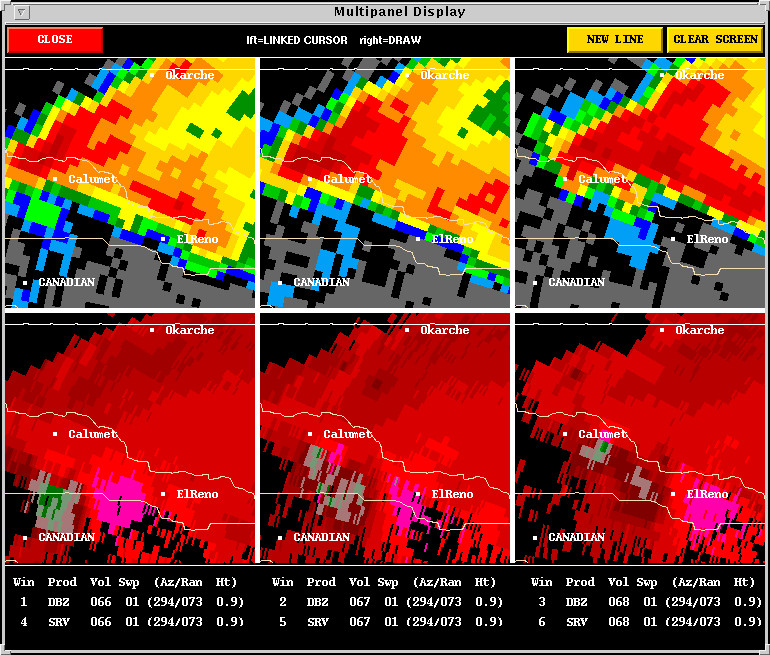
A tornado subsequently formed northwest of El Reno. The exact
time and location of this tornado are still being investigated. The
Six Panel Tornado Sequence follows
the storm through the time when the tornado most likely occurred.
-
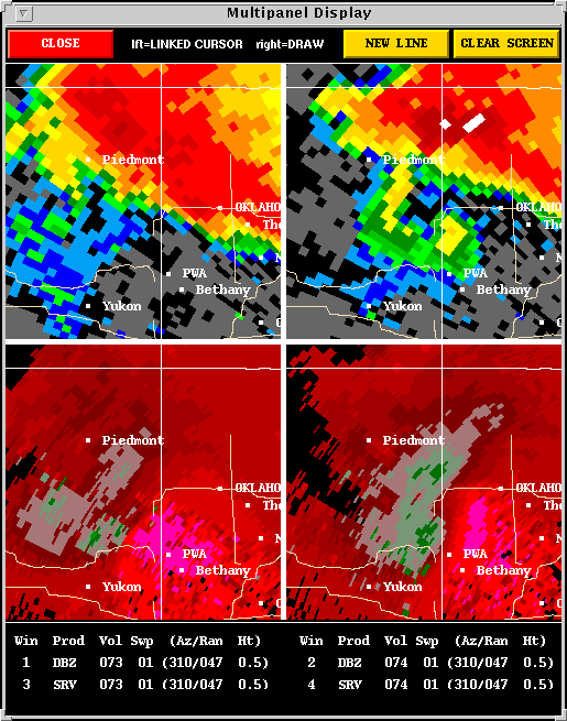
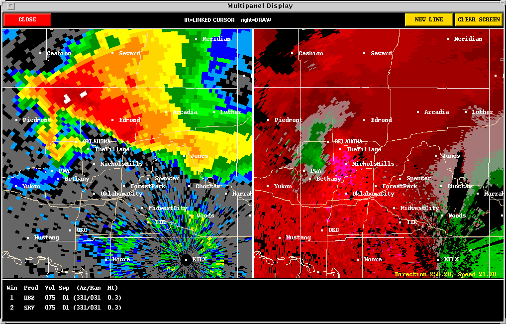
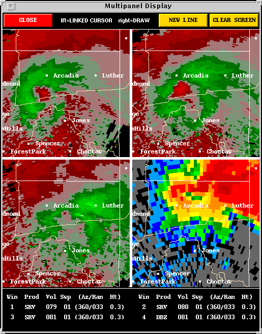
The Lake Heffner and Frontier City Tornadoes:
Description: Following the El Reno tornado, this supercell
thunderstorm went through a period of Reorganization
upon approaching northwest Oklahoma City. Between 0048 UTC and 0054
UTC a vivid hook echo materialized and base scan circulation increased
dramatically. At 0103 UTC a water
spout formed on Lake Heffner and quickly moved onshore doing significant
damage.
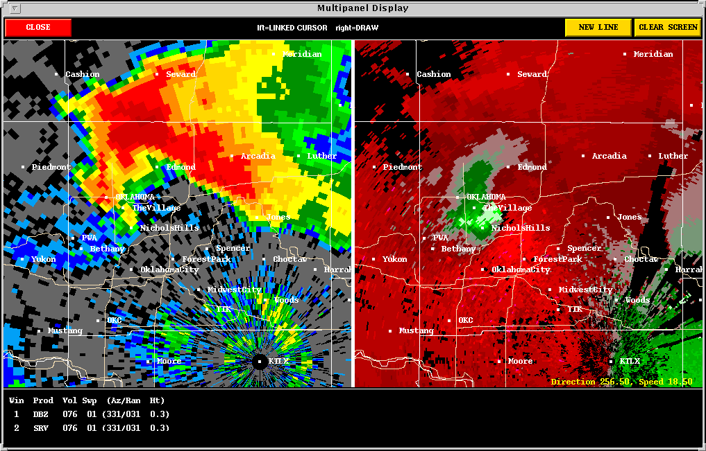
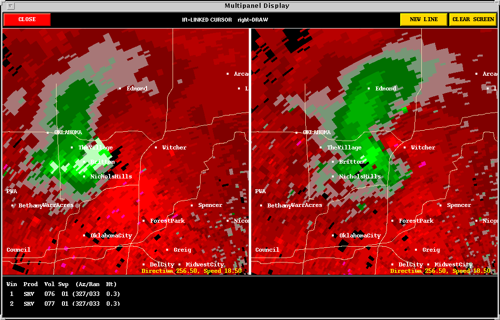
The 0106 UTC and 0112 UTC storm
relative velocity images were truly scary, showing an intense mesocyclone
just above the ground in a densely populated area. The 0124
UTC reflectivity image is equally as scary; when a "blob" of reflectivity
is observed at the end of a "fish-hook," a tornado is almost a guarantee.
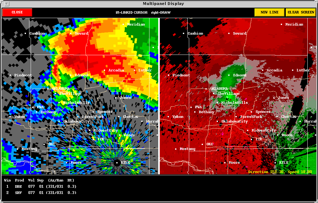
As it turned out, the meso dropped occasional tornadoes across north Oklahoma
City with the most intense damage being F2. There were no fatalities
and no serious injuries. The storm's circulation broke apart as it
left Oklahoma City (0130 UTC - 0142 UTC).
Here's
Jim Ladue's page on the 13 June 1998 OKC storm.
Back
to NSSL SWAT Case Study Table of Contents Page.