1NOAA/NSSL and
UW-Madison/CIMSS
Extremely dry soil, combined with periodic episodes of strong winds,
unseasonable warmth, and very low relative humidity have lead to the
high risk of wild-fires across portions of the Southern Plains from
late
December 2005 through mid March 2006. Very large fires in the
Texas Panhandle ignited on 12 March 2006, causing loss of property and
life.
This web site presents 1) maps of fire locations estimated from GOES
satellite imagery, and 2) high resolution animations of visible and 3.9
micron imagery during the afternoon of 12 March.
In addition, strong southwesterly surface winds behind a dryline on
30 March 2006 (two weeks after the fires) appear to have transported
surface debris from the fire scars in the form of dust or ash plumes
into Oklahoma. These plumes appear to be darker than dust plumes
normally observed in west Texas. Clouds appeared to form within
the plumes just west of the dryline in Oklahoma and these clouds may
have had a subsequent influence on the organization of ongoing storms
to the east, see Movie 3 (from Scott
Bachmeier, CIMSS).
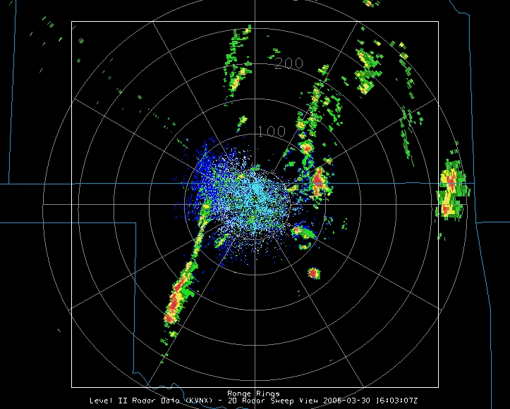
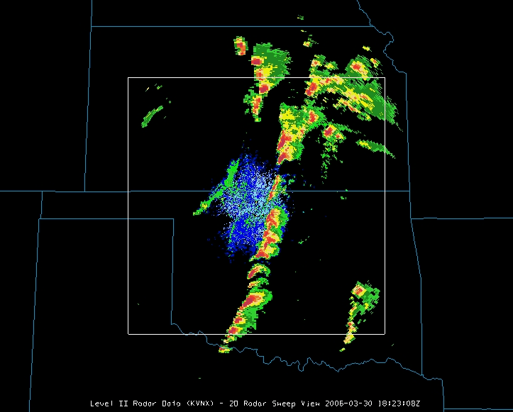
These dust plumes do not appear detectable in the WSR-88D
reflectivity data from nearby radars. However, a new fire in
northwest Oklahoma on the afternoon of 30 March was detected on the 3.9
micron GOES data. Although a smoke plume from this fire was not
apparent in the GOES visible imagery, the plume was evident from radar
reflectivity data observed from Vance Air Force Base in northcentral
Oklahoma. These data are presented in Table 1. Of interest is the
apparent entrainment of this plume into a developing line of
thunderstorms over southcentral Kansas along a confluent zone (likely
associated with the dryline).
| 1603-1901 UTC | 1823-1938 UTC |
1901-1959 UTC |
| Animated Gif | Animated Gif |
Animated Gif |
| Quicktime movie | Quicktime movie |
Quicktime movie |
Return to CIMSS
(UW-Madison)
or NSSL (NOAA/NSSL).
Last update was 08 June 2015. Feedback.