Research Tools: Decision Support
National Weather Service forecasters receive a firehose of information, especially when there is a threat of severe weather. The NOAA National Severe Storms Laboratory investigates methods and techniques to diagnose severe weather events more quickly and accurately.
MRMS
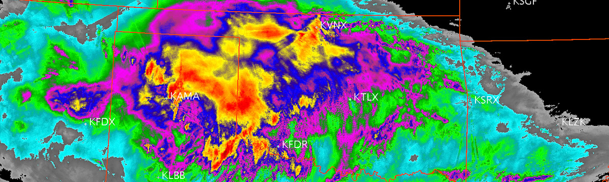
NSSL developed and implemented the real-time Multi-Radar Multi-Sensor system in 2004. The system quickly and intelligently blends data from multiple radar networks, surface and upper air observations, lightning detection systems, satellite and numerical weather prediction models. Numerous two-dimensional, multiple-sensor products offer assistance for hail, wind, tornado, precipitation estimation, convection, icing, and turbulence diagnosis.
MRMS was transitioned into operations at the National Centers for Environmental Prediction in 2014. MRMS provides severe weather and precipitation products for improved decision-making capability within NOAA. The operational MRMS products have high resolution and rapid updating capabilities. In addition to providing guidance to NWS for severe weather warnings, both the precipitation and reflectivity products are used for verification of forecasts from numerical weather prediction models. The precipitation products also serve as a ground-based verification of satellite precipitation estimates, and are a critical input to operational hydrologic forecast models. MRMS is a powerful tool for the creation and evaluation of new techniques, strategies and applications. New concepts and observing systems can be tested and easily plugged in and out of MRMS as they are developed. This process facilitates a rapid transition of new MRMS applications and products out to end users and decision makers.
PHI Prototype Tool
A prototype tool for testing and development of Probabilistic Hazard Information (PHI) concepts provides the ability to quickly incorporate new ideas, applications and research concepts prior to the transition to operations. The PHI prototype tool allows forecasters to create PHI for multiple hazards with live data or in archive mode examining high-impact events. This prototyping process of PHI provides early and collaborative development with both forecasters as well as end-users, such as emergency managers and broadcast meteorologists.
Concepts proven in the PHI Prototype are then implemented and further tested in an experimental version of Hazard Services, an application that serves as an operational channel for PHI. The experimental Hazard Services application is through a partnership with the NOAA Global Systems Laboratory. While Hazard Services is an effective and necessary testing platform, development efforts require more formal, detailed planning due to the sophisticated nature of the code base.
Severe Weather Research Map
The Severe Weather Research Map (SWRM) is an experimental web-based visualization tool providing researchers an interactive map of research data. With this tool, researchers and NOAA Hazardous Weather Testbed participants have the option to plot and interrogate different datasets that are relevant to severe convective weather, such as the Multi-Radar Multi-Sensor system. The SWRM supports research efforts by scientists, allowing them to test products that one day may be transitioned into operations. As an example, the SWRM allows researchers to view and analyze output from newly developed storm or tornado tracking algorithms during real-time and past weather events. Results of tracking algorithms display on the map as a polygon that encloses the area of interest. In the future, these polygons may be used as a basis for creating Probabilistic Hazard Information (PHI), which is a component of Forecasting a Continuum of Environmental Threats (FACETs) that communicates threat information geographically.
AWIPS2
NSSL has more than twenty NWS workstations — the Advanced Weather Interactive Processing System 2 (AWIPS2) — available for use in product evaluation. NSSL uses these AWIPS2 stations to test and demonstrate warning products and techniques that have been developed at NSSL that will be available in the NWS Forecast Office in the future.
NSSL Development Lab
NSSL's Development Lab includes multiple wall-mounted displays and 10 flexible workstations that can support AWIPS2 or other locally developed software and algorithms. With these capabilities, the area can act as an extension of the NOAA Hazardous Weather Testbed for larger experiments. A large round table occupies the middle of the room for focus groups. Researchers, forecasters, developers, and emergency managers use the lab to evaluate new platforms and techniques in real-time as a team. The workstations in the lab may be quickly adapted for visualization and incorporation of unique data sources including radar and satellite to facilitate research and discussion.