
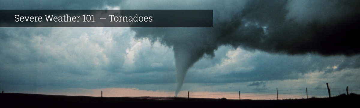
Severe Weather 101
Frequently Asked Questions about the ‘Twisters’ Movie
If your question is not answered below, check this excellent, comprehensive list of tornado FAQs from the NOAA Storm Prediction Center.
- Are overpasses dangerous in tornadoes?
- It might seem like a good idea to take shelter under an overpass or bridge during tornadoes or severe weather. However, that is absolutely not the case. In fact, overpasses may be one of the worst places to seek shelter from a tornado as they can actually put you at a much greater risk of being killed or seriously injured by flying debris.
Your best option is to pay close attention to the weather and not be on the road in severe storms in the first place. If you do encounter a tornado while driving, try to get off the road and find the closest sturdy shelter.
If you have no other options, pull over and park. Stay in the car with your seatbelt on. Put your head down below the windows, and cover up.
If you think you can get lower than the level of the roadway, exit your car and lie in that area, covering your head with your hands.
Unfortunately, none of those options are guaranteed to protect you, and your choice should be driven by your specific circumstances.
The bottom line is: overpasses are not safe shelter areas!Overpasses are one of the worst places to seek shelter from a tornado — find out what to do instead.
- Are fire tornadoes possible or real?
- While there are no known cases of a tornado impacting an oil and gas refinery and “catching on fire” as seen in the recent movie ‘Twisters’, there have been cases where the extreme heat produced by existing wildfires caused the development of severe thunderstorms and tornadoes.
In 2018, a wildfire near Redding, Cali., produced a supercell storm and eventually a large, strong tornado that caused EF3 damage to the surrounding communities. Fire could be seen in the lower levels of that tornado.
These events are exceptionally rare and are different than the small, very brief fire whirls you might see in a wildlife from time to time.Could a "fire tornado" happen in real life? Learn the facts behind the flames.
- Do tornadoes ever occur without warning?
- The National Weather Service is constantly monitoring the environment for tornadoes and severe storms. Watches may be issued hours in advance of tornadoes, and especially for the most dangerous violent tornadoes, we’re usually able to get tornado warnings out 15 to 20 minutes in advance.
But the warnings don’t work if you don’t know about them. So how can you be sure you are weather aware and able to receive these life-saving alerts?
It’s critical to have multiple ways to get warnings, and today we have more options than ever to choose from. This includes mobile apps and wireless emergency alerts on your phone, TV, radio and NOAA Weather Radio, and even sirens. Never rely on sirens alone - they are really intended for people who are outside.
Always have multiple ways to receive warnings, whether through your cell phone, TV, radio, NOAA Weather Radio or other sources, having backups ensures that you are informed when deadly weather threatens.Explore the ways you can be notified in advance of a tornado or severe weather.
- Is it possible to disrupt a tornado?
- You may have seen this concept in the new movie ‘Twisters’. While it sounds like a great plan, the reality is quite a bit different.
Tornadoes and the storms that form them are massive, complex systems that contain unfathomable amounts of energy. In order to disrupt these systems, you would need comparable amounts of force and energy that are simply not possible to deploy with the speed and precision that would be necessary to “kill” a tornado. In fact the movie depicts just how dangerous and destructive even attempting something like this would be for those involved.
Additionally, the side effects of manipulating nature in this way are unknown and could likely cause as much or more damage as the tornadoes themselves.
The best way to keep yourself safe from tornadoes is by being weather aware and making a plan so you know where to go and what to do when severe weather threatens.Is it possible to tame a tornado? Short answer: No. A NOAA scientist explains why.
- What is storm chasing?
- You might have seen dramatic videos on social media or the movies of people “storm chasing”. Often these chasers get dangerously close to tornadoes to try and capture the most dramatic footage possible. And some even attempt to get inside tornadoes.
While this kind of storm chasing makes for dramatic photos and video, here at the NOAA National Severe Storms Laboratory our mission is science, not drama.
For more than 60 years, NSSL has been getting out into the field to study tornadoes in the wild. We take our instruments to the storms and put our scientific hypotheses to the test, and we always make sure safety is our number one priority.
Our work through the years intercepting and studying storms has been a huge part of helping forecasters create longer lead times and better forecasts.NSSL's mission is science to save lives and property. Find out how NOAA safely studies tornadoes in the field.
- What is phased array radar?
- NSSL has been the world’s leading developer of weather radar technology for more than 60 years, and we’re currently hard at work on the next generation.
Current weather radars mechanically rotate and tilt the radar dish to sample different parts of the atmosphere. A phased array radar (PAR) has a unique flat panel antenna that remains stationary. The panel is made up of a grid of fixed antenna elements, and each can transmit and receive a signal. As a result, the radar beam can be steered electronically, giving users the ability to control how, when and where the radar scans.
PAR can scan the sky in less than a minute, revealing critical weather thumbprints that point to the potential of severe weather. Radar scans every minute will make severe weather easier to confirm, making warnings more accurate and reducing false alarms. Forecasters will also be able to watch changes in the storm to know when it is strengthening or weakening. NSSL scientists have already learned more about thunderstorms with PAR data.
Simply put, PAR offers meteorologists faster radar updates, better resolution and detail, and a more accurate picture of what’s happening in a storm. While not in operation yet (and not small enough to fit in a car like you might have seen in ‘Twisters’ the movie) phased array has the potential to push severe weather forecasting and warning forward. Ultimately with the goal of protecting property and saving lives.NSSL has been the driver of weather radar research and advancement for more than 50 years and we're hard at work on the next generation of radar technology.
- Do NOAA scientists use drones for storm chasing?
- Tornadoes are one of the most destructive forces of nature. That makes studying them challenging as it can be difficult and often dangerous for scientists to get close enough to accomplish their missions.
One of the tools used at the NOAA National Severe Storms Laboratory to overcome those obstacles are Uncrewed Aerial Systems or UAS.
Whether copters or fixed-wing, NSSL uses a variety of platforms to observe and measure the atmosphere near tornadoes before and during the storm. That data is sent back to forecasters on the ground in real time.
UAS is also a useful tool to assist in damage assessment after a tornado, helping researchers better understand how ground-level winds in and around a tornado do damage to various structures and vegetation.
In the future NSSL looks to expand UAS applications to fire-weather, marine and hurricane environments and even emergency response.Studying tornadoes is challenging as it can be difficult and often dangerous for scientists to get close enough to accomplish their missions. One of the tools used here at the NOAA National Severe Storms Laboratory to overcome those obstacles are Uncrewed Aerial Systems or UAS.
- Are “twin” tornadoes possible?
- The answer is yes! Often a tornado will form multiple “vortices” or what appear to be separate cones that spin around the main part of a tornado. While there appear to be many tornadoes, this might still be considered a single tornado, depending on how close they are to each other and whether they are from the same larger circulation.
But having two distinctly different tornadoes simultaneously and very near each other is also possible and has happened. This typically occurs when the first tornado begins to move towards the rear of the parent larger scale rotation, a process called “occlusion” whereby the storm is essentially ejecting the rotating column. While this process is occurring, sometimes the same storm can produce a new area of rotation and consequently a new tornado, even though the original one is still on the ground.
We also sometimes see two tornadoes at the same time that spin in opposite directions forming on the left and right sides of the rear flank downdraft of a supercell thunderstorm. The stronger one on the left side rotates anticlockwise, as most tornadoes do, and the weaker one on the right side rotates clockwise.
While these events are relatively rare, they are in fact real and not Hollywood fiction.While these events - whether multiple “vortices”, two nearby tornadoes simultaneously, or "satellite" tornadoes - are relatively rare, they are in fact real and not Hollywood fiction.
- What happens when two tornadoes come together?
- That is more unusual than it seems, because most video that seems to show tornadoes merging actually involves either one tornado, or one among multiple subvortices, going behind another. On those very rare occasions when tornadoes do merge, it usually involves a larger and stronger tornado that simply draws in and absorbs the lesser circulation, then keeps on going.